
A narrow channel cut into volcanic rock. A hillside of salt ponds. Tree roots beside tidal water and a river among waterfalls, villages and farming terraces. In travel photographs, Cumbemayo, Maras, the Tumbes mangroves and Nor Yauyos Cochas may appear unrelated. Water gives them a shared story: how it shapes a landscape, how people direct it and what kinds of work have developed around it.
That connection is a way to follow your interests, rather than a route requiring all four places in succession. Cumbemayo draws attention to an archaeological intervention in stone, Maras to salt extraction, Tumbes to a tidal forest and Nor Yauyos to an entire river landscape. Choose what makes you curious. Understanding two places can add more to a journey than collecting four photographs for a similar patch of blue or white.
Cumbemayo: a human line among the rocks
Outside Cajamarca, Cumbemayo’s volcanic rock formations are known as Los Frailones. Erosion shaped these large forms. Alongside them is a channel cut into the rock by people. The official inventory describes straight sections, sharp angles and a slight gradient. The contrast is one of scale: the formations establish the landscape from a distance, while the channel draws your attention to a much narrower line. Cumbemayo near Cajamarca
Follow that line with your eyes. Where does it change direction? How does the channel’s edge compare with the irregular rock alongside it? You do not need a complete explanation for every turn to recognise the human work. The inventory suggests a possible function for the right angles, but a proposal is not a settled answer. The form itself already gives you something to look at carefully.
Consider Cumbemayo during a stay in Cajamarca if the relationship between water and stone interests you. It offers a different subject from church façades on a city walk or a museum collection. Take one question into the visit: what has erosion shaped here, and what have people made? The same view gains several layers without requiring the whole story to fit into a single date or cultural label. Three days in Cajamarca: Belén and Cumbemayo
Maras: salt appears as water disappears
The Salineras de Maras are in the Cusco region. A saline spring feeds a network of channels and ponds arranged in steps down the hillside. The inventory describes water distributed by gravity, with the shallow ponds used for evaporation. The white patches are only part of the interest. Their pattern shows how a spring, a slope and a constructed system combine to make salt extraction possible. Maras salt ponds: a working landscape
The Ministry of Culture links these techniques to knowledge passed between generations within the communities of Maras and Pichingoto. That gives the landscape a human meaning. The ponds belong to work, knowledge and the histories of the communities involved, as well as making a striking pattern. Pay attention to the connections between the individual shapes rather than only taking in the whole view.
One detail to notice: the branching channels
Look for the difference between a larger supply channel and its smaller branches. That detail turns a collection of ponds into a connected system. You can compare it with Cumbemayo while keeping the places distinct: there, a water line cut into rock; here, a network dividing water between many individual ponds. The similarity gives you a question to explore. The functions and local histories remain different.
Tumbes mangroves: a forest with tides
Near the Ecuadorian border, water takes on another role. The Tumbes mangroves are a coastal ecosystem where marine and freshwater influences meet. SERNANP describes mangrove trees adapted to saline water, growing on ground that is alternately flooded. Forest, roots and estuary channels make up the landscape. This offers a different coastal experience from an open beach whose horizon immediately draws your eye. Los Manglares de Tumbes
Notice the relationship between trees and water. Where is the waterline in relation to the roots, and which parts of the ground can you see? High and low tides are part of the place’s character; the setting does not stay identical throughout the day. A photograph does not tell you how it will look at the moment of your visit. That changing appearance can itself become part of your interest in the landscape.
SERNANP also describes the importance of mangrove products to neighbouring communities, including traditional gathering and trade. Water acquires a third role here alongside forest and tides: it is part of people’s livelihoods. Keep that relationship in mind when looking at the channels. A protected natural area and a landscape used by people can belong to the same story rather than being treated as separate subjects.
Nor Yauyos Cochas: look at the river’s surroundings too
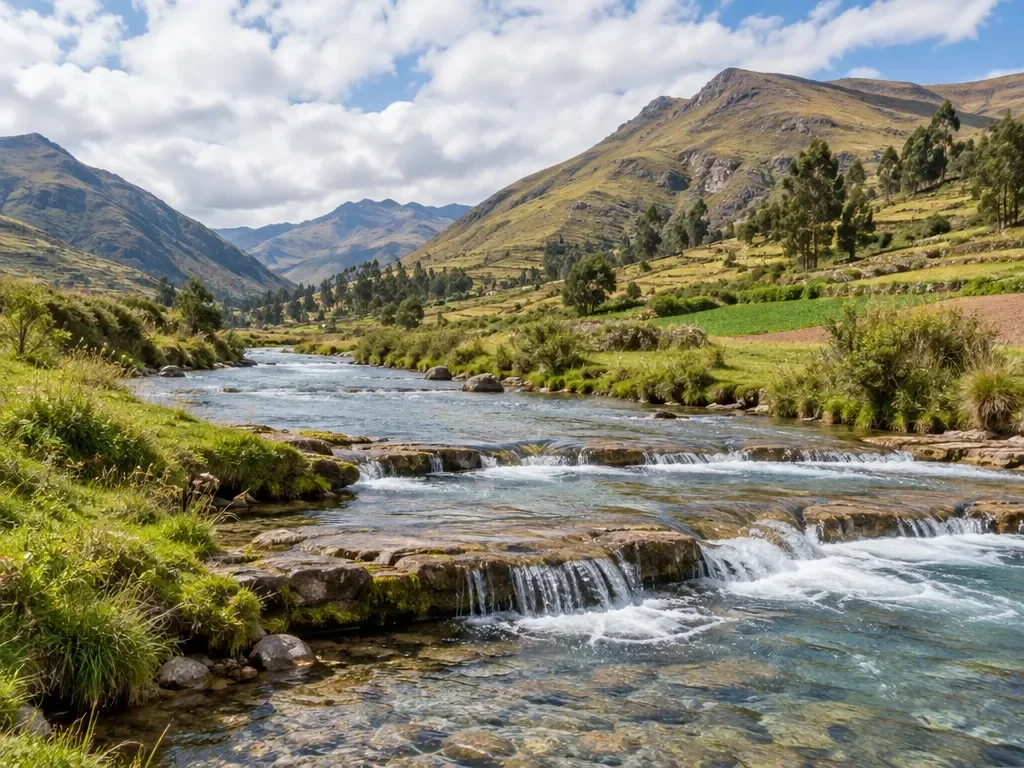
The Reserva Paisajística Nor Yauyos Cochas includes parts of the Cañete and Cochas Pachacayo catchments in the mountains of the departments of Lima and Junín. Here, Lima means the department rather than the capital city. Waterfalls near Huancaya and Vilca are recognisable elements, but the reserve also contains lakes, villages and farming terraces. A waterfall is one detail within a much larger area.
SERNANP describes the relationship between the protected landscape and farming communities’ activities. Its account names terraces around Laraos, Carania and Vitis and explains that some traditional terraces remain in use as living heritage. That makes the river’s surroundings interesting alongside the water itself. Look at the lines of fields and terraces on the slopes and the position of a village within the valley. Long human use has shaped this landscape too.
Choose this perspective if relationships on a larger scale interest you. The subject becomes the river, hillsides and settlement together rather than a single archaeological channel or salt pond. Give a stay in the area a reason of its own. Seeing Lima on the map is not a reason to treat Nor Yauyos as another city outing. Begin with the landscape you want to understand, then work out the separate practical planning. Nor Yauyos-Cochas
Which question will you take with you?
For engineering and archaeology, Cumbemayo offers a reason to look more closely at stone. Maras adds water distribution and knowledge of salt extraction to a journey in the Cusco region. Tumbes centres on the influence of tides on a forest; Nor Yauyos on a river and its inhabited mountain surroundings. There need not be a winner. Choose a difference you want to compare with another place: a narrow line and a whole network, or the rhythm of tides and the use of a river valley.
Alongside an overall photograph, keep a note of one detail: an angle in the channel, a branch beside the salt ponds, the waterline along roots or a terrace above the river. Record what you actually saw and which question remains unanswered. Water can then become more than a colour in a photograph: it offers a way to look at Peru with greater attention.