
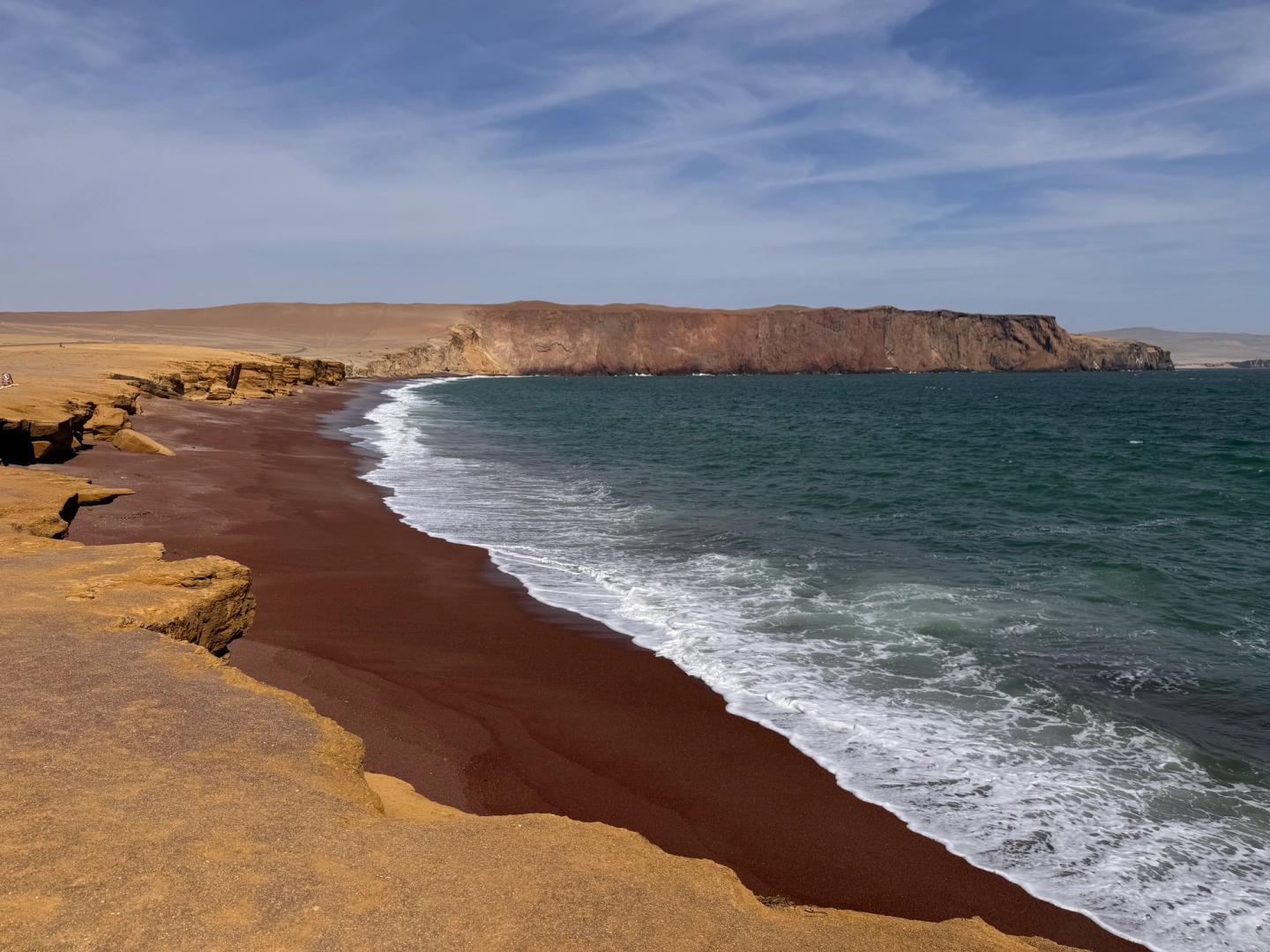

At Paracas the desert does not gradually give way to a green coastal strip. Dry ground, steep edges and ocean sit beside one another. The water is more than a background for a beach photograph: it belongs to a protected marine-coastal landscape, with birds, fishing and a history of people living from the sea. That contrast between sparse land and productive water gives the reserve its character.
SERNANP describes the reserve as protecting marine and coastal ecosystems as well as archaeological heritage. Its extent goes far beyond a road linking a few familiar viewpoints. A visitor does not need to cover all of it. Instead, choose the relationship you want to explore: coastal formations, life around the water or the traces of Paracas culture. That gives a route a subject.
The reserve and Ballestas are two plans
Paracas National Reserve and the Reserva Nacional Sistema de Islas, Islotes y Puntas Guaneras are separate protected areas. SERNANP distinguishes them in its 2026 account of the coast and Ballestas. A mainland circuit and boat trip may be sold together, but they remain different visits. Establish the route, departure point, interpretation and arrangements for each component.
We suggest keeping the reserve visit from becoming dependent on every other activity that day. If Ballestas is also a priority, compare the actual programmes and leave space between them. If coastal landscape is what interests you most, choosing the mainland alone is reasonable. A boat trip is not a compulsory first half of every Paracas visit; our separate Ballestas guide covers that decision.
Let viewpoints become more than photo stops
SERNANP’s publication names Supay, La Catedral, the Istmo, Playa Roja and Lagunillas among the coastal viewpoints. Use those names to make a programme concrete rather than as a checklist. Which formation interests you, where do you want to spend time looking and which stop adds something different? Then ask the provider to describe the actual order and available sectors.
At La Catedral the name carries history. The well-known rock formation was damaged in the August 2007 earthquake; SERNANP notes that its former shape can no longer be seen. An old travel photograph is therefore not a current promise. Look at the remaining coastline and ask how sea and rock shaped it, rather than searching for one vanished photographic frame.
Try a simple comparison at a stop: what changes between a high coast, a bay and the edge of a beach? Notice lines, colour and the meeting of land and water. You do not need to be a geologist. A few minutes of focused looking can offer more than moving on because another stop remains. Take the photograph, then give yourself a moment without the screen.
A habitat, not an appointment with an animal
The reserve protects habitat for coastal and migratory birds. The February 2023 PROMPERÚ/SERNANP leaflet describes it as a resting and feeding place for migratory shorebirds. That helps explain why water, shallows and their surroundings matter together. It does not identify which bird will appear during your stop. Choose observation time because you want to look, rather than because a species list promises an encounter.
At Lagunillas the working coast becomes more visible. The MINCETUR entry describes the fishing cove and landed fish beside the beach landscape. It offers a different perspective from an empty desert meeting the sea. For a meal break, agree the actual address and time. A place name on a route is neither a reserved table nor an assessment of a restaurant.
For archaeology, consider Julio C. Tello
Museo de Sitio Julio C. Tello gives archaeology its own place in the day. Its listing places it at kilometre 27 of the Pisco–Puerto San Martín road, inside the reserve. That differs from the natural-history interpretation offered by an interpretation centre. Use the full museum name in an outing request; “an information centre” may describe a different visit.
The museum’s own listing publishes Tuesday to Sunday, 09:00–17:00. Keep those hours separate from the arrangements for a reserve circuit and establish last admission, the museum ticket and interpretation. The 2023 map places museum and reserve route in the same area, but a shared map does not prove a combined ticket or identical opening hours.
Start with how the day will work
For a circuit, ask for named stops, where you actually get out, which parts involve walking and how much independent viewing time is offered. Record the starting and finishing points and whether lunch or a museum has time allocated. This lets you compare shared transport, a private vehicle and a guided outing by substance. “Tour” says little about what happens between photographs.
A beach view does not turn the day into a beach day. If you want a longer stay or an activity on the water, establish arrangements and current instructions for that particular place. A brochure inspires a journey rather than confirming conditions on your date. SERNANP asks visitors to follow ranger instructions; an attractive travel image cannot replace that information.
Keep luggage collection and onward travel to Ica or Lima separate from the visiting arrangement. Combining them is not inherently impossible; you need to know who waits for what. Our suggestion is a reserve visit with one clear focus followed by a separate departure. If you are already checking the time for a bus halfway through, another viewpoint seldom makes the day easier.
Choose Paracas for the connection between desert, sea and people. Time at two or three chosen places can reveal more than a long succession of photo stops. Give the museum its own place if ancient cultures are your main interest. Choose Ballestas separately if you want the offshore islands as well. There is no need to force every experience under one name.
Places to stay in Paracas
Compare accommodation locations in Paracas as a base for visiting Paracas.