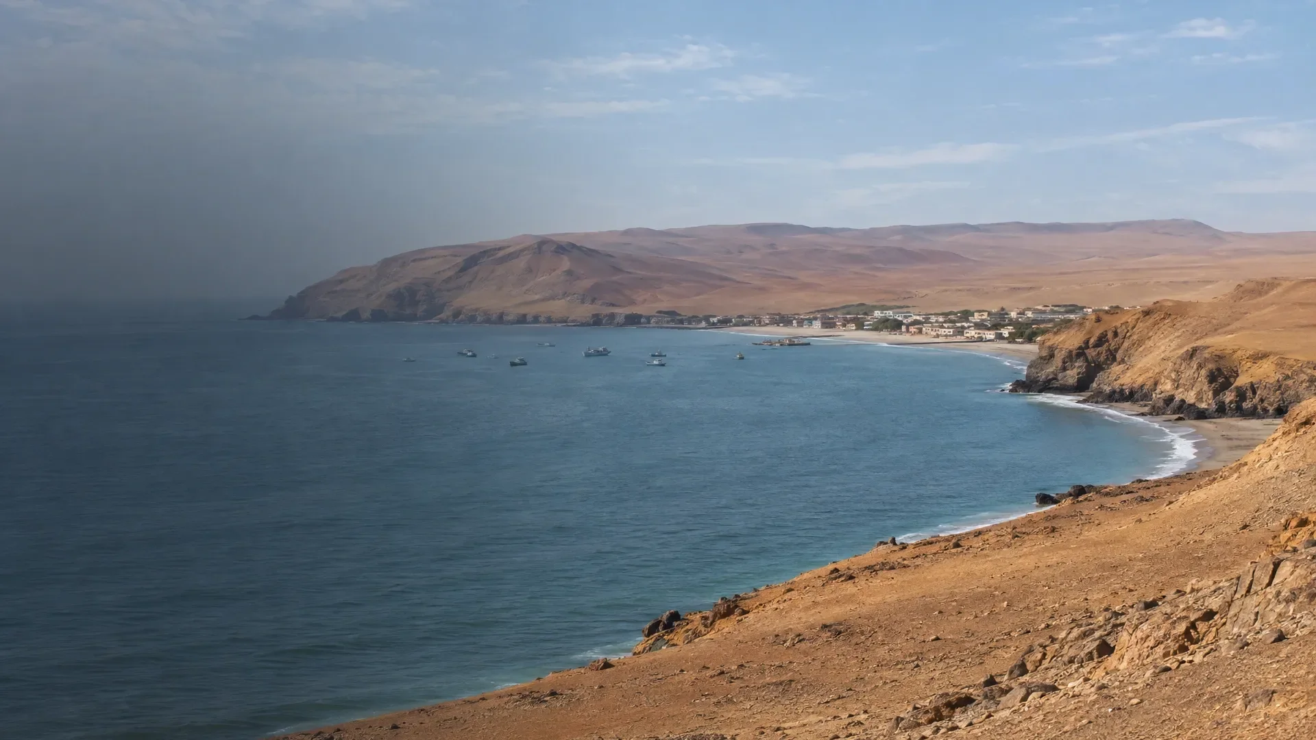
Paracas sits on a sheltered bay where Ica's coastal desert meets the ocean. In El Chaco, the small visitor hub by the water, hotels, restaurants and excursion offices cluster near the jetties. The town itself is quickly understood. The landscape around it is not.
Across the peninsula, bare plains, cliffs, red and gold beaches and quiet bays replace one another. The terrain can look empty, yet the national reserve protects marine ecosystems, desert, bird habitat and archaeological remains. The Centro de Interpretación and Julio C. Tello museum make those connections easier to see.
Offshore, the three Ballestas Islands belong to a different protected area. A boat visit focuses on rock arches, sea lions, Humboldt penguins and guano birds, all watched from the water. Paracas is therefore not a village with one headline attraction, but a base for two distinct nature experiences — and for food tied closely to fishing in the bay.
Two reserves often collapsed into one
Paracas National Reserve encompasses coastal desert, bays and a large marine area. The Ballestas Islands form part of the National Reserve System of Guano Islands, Islets and Capes, a chain of protected sites along Peru's coast. They sit close together on a map but ask different things of a visitor. The peninsula is about landscape, geology, culture and coastal ecology. Ballestas is a boat circuit with wildlife at its centre.
If you have time for both, treat them as two visits. If you must choose, follow your interest: firm ground and viewpoints in the reserve, or a boat and island wildlife. A combined package can simplify logistics, but confirm which land stops it actually includes; 'Paracas tour' is not a route description.
The peninsula: a desert with a coastline
The national reserve is not one beach and one photo stop. The official northern visitor circuit identifies La Catedral, Yumaque, the isthmus viewpoint, Playa Roja and Lagunillas among its features. The distances between them make transport part of the visit. Decide whether your priority is the wider landscape, the museum or more time beside a bay.
Playa Roja and the isthmus: colour and scale
At Playa Roja, a red strip of coast meets yellow cliffs and blue-grey water. It is primarily a viewpoint, not a challenge to get as close as possible to every patch of sand. From the isthmus mirador, the peninsula's shape becomes clearer: bays and open sea on either side, with a dry expanse between them.
La Catedral: a coast that keeps changing
La Catedral was known for its natural rock arch, but the 2007 earthquake radically changed the formation. That makes it a useful place to consider erosion and movement rather than searching for an old postcard. Stay at the designated viewpoints and follow any closures.
Lagunillas: fishing bay and lunch stop
Lagunillas lies inside the reserve, with an artisanal fishing landing and restaurants around the bay. It is a natural pause between viewpoints. Look at what has actually been landed and prepared that day rather than automatically working through a long menu. Works or rules around fishing infrastructure may alter the practical situation, so follow the designated visitor route on arrival.
La Mina, Raspón and Yumaque: beach does not mean one plan
La Mina and Raspón occupy sheltered coves; Yumaque opens more broadly along the coast. The managing authority regulates use and facilities by sector. Decide whether you want a viewpoint, walk, picnic or time on the beach, then consult current SERNANP guidance for that activity. The presence of water does not automatically make a place suitable for swimming on the day you visit.
Start with the story: interpretation centre and bird trail
The Centro de Interpretación and a bird trail sit by La Aguada. They make a worthwhile first stop if the empty plain still looks like little more than sand and sea. The interpretation connects the productive coast, migratory birds, fishing and conservation. Binoculars will often add more here than yet another wide-angle photograph.
Museo Julio C. Tello: Paracas is also a culture
The Julio C. Tello Site Museum stands in the reserve near archaeological sites on the peninsula. Its permanent rooms show objects from the Paracas culture, including ceramics, textiles and tools, and explain how people related to this dry coastal environment. The name Paracas regains a historical meaning here, alongside hotel, boat and national reserve.
Build the museum deliberately into your land circuit; it is not on El Chaco's waterfront. Visitors drawn mainly by wildlife gain context on human life along the same coast. If archaeological human remains or burial contexts are a concern, ask in advance what the current display includes.
How do you want to move through the reserve?
A guided vehicle makes the distances straightforward and may add useful explanation, but it also fixes the pace and stops. Driving yourself offers more freedom as long as you remain on authorised routes. A bicycle makes the landscape slower and more tangible, but wind, sun, water and the return journey then become central parts of the day. Before renting, ask about the route, bicycle condition, helmet, breakdown support and return deadline.
Ballestas: watching from the water
Ballesta Norte, Centro and Sur are rocky islands shaped by marine erosion. Sea lions and several seabird species live on and around them; Humboldt penguins also occur here. The visit is a wildlife-watching circuit by boat. You observe colonies and rock forms without treating the islands as a place to walk.
A protected habitat is not a show with a fixed cast. Animals may be close, distant or out of sight. Bring binoculars if you can, and listen for the explanation of guano birds and the cold, productive sea. The trip then remains worthwhile without making one penguin responsible for the entire morning.
El Candelabro without a tidy theory
El Candelabro is a large geoglyph on the peninsula slope, most legible from the sea. Its maker, date and meaning have not been established convincingly. A guide may discuss the different hypotheses, but there is no conclusive explanation.
Choose the boat by its operation, not departure time alone
Ask where boarding takes place, how seating is arranged, what lifesaving equipment is carried and what happens if the port authority or reserve does not permit departure. Also ask the provider to confirm that the operator and vessel are authorised for your sailing and where you can verify that.
Anyone prone to seasickness, unable to board a small craft easily or uncomfortable sitting steadily for the circuit should discuss it before paying. A land route through the reserve is not a lesser Paracas; it is a different visit with more control over stops and rest.
Let the catch choose the meal
Paracas Bay is more than scenery. Artisanal fishing forms part of the protected coast and local economy. In a recent project, SERNANP documented cabinza, sole, pampanito, chita and silverside among fish caught in the area. That does not determine today's restaurant menu: in El Chaco or Lagunillas, ask what is available and how it is prepared.
- Ceviche: ask for the fish of the day and portion size; the dish need not disappear beneath a mountain of mixed seafood.
- Fried or grilled fish: a simple preparation makes differences between species easier to appreciate.
- Shellfish and crustaceans: ask what is available and how the kitchen prepares it.
- Pisco: the namesake city and wine valleys lie in the same region, but a tasting is not an automatic part of every Paracas visit. Choose one separately if production and grapes interest you.
Stay by the pier or farther around the bay
Around El Chaco, you are close to restaurants, booking offices and many departure points. That is useful for an early appointment and walking to dinner. Larger hotels also sit farther along the bay; peace and space may matter more there, but you will more often arrange transport to the jetty or village. Always confirm the real address and your boat's boarding point.
Traffic, music or an early group can be audible by the waterfront. A 'sea-view room' says nothing about windows, street exposure or quiet. Ask. For one night, walking distance may be decisive; over two nights, the quality of the property itself matters more.
One full day or room for change?
One full day can combine a boat outing with a compact land circuit if both operate and the transport joins up. You will meet the islands and peninsula, but leave little time for the museum, bird trail or a longer beach stop. If you arrive halfway through the day, use the afternoon for the reserve or bay and consider the boat the following morning.
Two nights give the coast breathing room. You can separate boat and land visits, add the museum or absorb a change in sailing plans without immediately losing your bus to Ica. If you do not want to sail and only want a short scenic circuit, one night may be quite enough.
From Lima into the southern desert route
Paracas fits naturally between Lima and Ica or Huacachina. If you continue to Nazca, keep those visits separate from Paracas nature: geoglyphs, archaeological sites and a possible flight require a new set of choices. For any bus ticket, confirm the exact departure and arrival point, then arrange the final leg between the stop and your accommodation if needed.
Places to stay in Paracas
Compare the locations of places to stay in and around Paracas.
Where is it?
Paracas and the surrounding area.